
The Alaska Highway (or Alcan: Alaska Canada Highway) runs 1,387 miles from Dawson Creek BC to Delta Junction AK. On my trip from North Carolina to Alaska and back, I took a ferry from Bellingham, WA to Skagway, AK. I decided on Skagway as my final port on the Alaska Marine Highway (the ferry system) because there was a road that connected to the Alaska Highway. That meant I could return down to mainland United States via the roads. This part of my trip was by far what I was most apprehensive about before departing Durham, NC. Going solo in a 25-foot RV on some of the most remote roads in North America without a copilot, a spare tire or cell coverage is intimidating. In fact, I got about 3 hours sleep before ascending the Klondike Highway which originates in Skagway and travels up 15 miles with an 11% grade to White Pass. I was so fortunate on the morning when I departed Skagway because it was calm and foggy. Wind, a high-profile vehicle and shear drop offs are not a good mix for me, so being shrouded in fog and stillness was actually a good thing; out of sight, out of mind. I hooked up with the Alaska Highway in the tiny town of Carcross originally called Caribou Crossing (population 301).
This is what I found after traveling 855 miles on the Alaska Highway:
Wildlife. The minute I got on the Alaska Highway out of Carcross YT, I saw a moose on the side of the road. I have waited my whole life to see a live moose (including several trips to Maine) and I was taken aback by the size of her eating along the side of the road. Just outside of Watson Lake YT, there was an entire herd of bison on both sides of the highway. I would guess upwards of 40 bison eating along the side of the road. I saw a fox, bighorn sheep and caribou as well. In fact, if you drive the Alaska Highway, I challenge you NOT to see wildlife. I was on high alert for most of the drive because they mark the areas where there may be wildlife present.
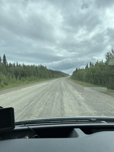
Highway. I would loosely call this a highway. There was never a section of divided, fully marked, four lane immaculately paved road. There were sections for upwards of a mile or two where the entire width of the road was gravel due to construction. I would bet that, especially the roadway in the Yukon (the entire population for the territory is 40,000!) and northern British Columbia, that 40% of the road was unmarked; So, passing vehicles in the opposite direction is a game of trust. I would guess that it’s about 50% trucks and 45% Recreational Vehicles on the road with motorcycles, SUVs or even a brave bicyclist for the last 5%. There were almost always ample gravel shoulders but who wants to drive 55 miles an hour on a gravel shoulder. It’s not like there was much traffic, especially in the Yukon. Canada uses completely different road signs to indicate rough road, wildlife ahead and so on. The funniest one is of a metal bridge which shows the person being rattled. There are also random box trucks left to decay but have an advertisement plastered on its side. The highways are a unique experience.
Services. If I saw a gas station, I filled up. Sometimes the road would have a warning that there weren’t services for the next 133 KM, sometimes not. If I saw a gas pump and I still had 3/4 of a tank of gas, I still filled up. When you might see only a handful of vehicles while driving all day, the last thing I wanted was to run out of gas. I saw maybe 4 businesses (i.e. restaurants, gas stations and lodges) that were actually open between Carcross and Watson Lake. I assume that COVID wiped out a lot of the businesses up here but I ended up eating in my RV for the first two days on the Alaska Highway. I can’t imagine not having at least a tent on this trip as I only saw a handful of lodges on the entire route. There were several businesses that hung a “closed” sign out front and most were dilapidated. I kept thinking, thank god I wasn’t depending on that place to be open.
Metric. Being fully versed in the metric system before driving the Alaska Highway would have been very helpful. Sure, I’ve been to Europe but I have never driven in Europe. All the signs are in kilometers which I basically just divided by two even though that is not accurate. I was fortunate that my speedometer has metric although it’s small print. The km per hour were constantly changing depending on the condition of the road. In addition, and probably the most startling is when a bridge would put that limit of weight in grams. I had no idea how many grams my 11,000-pound RV was but I had to assume that the gas tanker I passed an hour ago must have gone on the same bridge. I was definitely doing it scared. And then there were the gas stations. I can tell you have absolutely no ideas how much gas I purchased and if I paid $2.00 a gallon or $100 a gallon. Between liters and the Canadian dollar and the fact that the price was irrelevant if it was the only station for the next 150 miles. The metric system had me flummoxed.
Views. I was amazed by the sheer beauty that was around each corner. I was very fortunate that the weather was great on the four days I was traveling on the Alcan. Whether it was glacier lakes, meandering wild rivers, wildlife, miles of aspen and pine trees or the stunning views of long-lost mountains, each turn was a gift. Some rivers were bright turquoise and some were black, some groves of tress were decimated by fires and some were deep green and endless. It’s a fascinating journey that a good portion of the world never gets to experience. I would think about pulling off on a random side road but since they were all narrow and gravel, I demurred. The last thing I wanted to do was end up on a dead end and unable to turn around. I think of all the pictures I wanted to take but sometimes I just needed to experience regardless of whether I was able to document it.
Dawson Creek is the end (or in most cases the beginning) of the Alaska Highway. It’s definitely where I saw my first McDonalds in several weeks. There are traffic lights, divided highway, neighborhoods, and the roadway is clearly marked. All the things I take for granted back home. I am happy to report that my GPS worked for the entire route although I did have the Alcan bible, “Milepost” (a book with every highway and milepost detailed for Alaska and Western Canada). In retrospect, I’m glad I took on the journey with my RV, Abeona, because I’m so much more self-reliant. I know that so long as I am prepared, calm and focused, I can accomplish almost anything.
