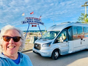
I recently wrote about why I ended up traveling alone in an RV and how to travel alone. This piece is aimed at the biggest stumbling block for me and that was getting past the fear of being alone in a strange place in an RV I barely understood. My first night in the RV was with my son, Benson. He was basically my ride to pick up Abeona when she was delivered to the dealership. In retrospect, I’m really glad he was game to sleep in the RV with me that first night and having a 20-something weight lifter right by the door was a certain amount of security. I’m sure that if I had been alone, sleeping in the dealership lot all by myself would have been much scarier. I realize now that knowing that there are other paying campers nearby has been a security blanket of sorts.
I am most vulnerable when I go to sleep. I want to know that everything is locked up and that no one can see inside my rig. I have a curtain that snaps into place across the driver and passenger seat in the front. For the first month or so that I initially traveled alone, I would make sure that all the curtains were draw. No one could see in and I couldn’t see out. It’s easier for me to sleep and change into my pajamas when I know my space is private. I also have a headset that I can sleep in that can emit white noise to help me sleep. It’s helpful for noisy neighbors or the if the campground is too close to an interstate or railroad tracks. Managing my senses of sight and sound keeps me feeling secure.
Paying for where I stay. This was by far the most important safety item for me in the first two years of solo rv-ing. I am a woman traveling alone and I want to know that I have a place to stay and that they are expecting me. There are all kinds of folks out there boon docking for free and I’m sure it’s cost effective and there is magic in the journey of discovering a campsite down a 16-mile gravel road with a tremendous view. It’s just not for me. I want to know that someone is expecting me, that I paid to be there and that I have a spot to plug in Abeona.
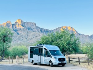
I purchased a brand-new RV. It’s also a very high quality RV. I wanted to know that at least for the first 5 years, I wasn’t likely to have anything catastrophic happen. I’ve watched enough RV YouTubes where certain makes and models have systems break down. I also get my RV checked every spring before I head out to make sure all the systems are working correctly including the air conditioning and water systems. It doesn’t mean I won’t get a flat tire or run over a boulder and break my sewer pipe but I feel confident that the engine will get me up the side of a steep canyon and the brakes will work coming down Tehachapi pass! I remember getting in a two hour back up coming out of Scottsdale in 105 degree temperatures and seeing several vehicles on the side of the road. Driving a quality vehicle helps me sleep at night.
I read reviews on the campgrounds that I stay at. If I read anything like “sketchy” or “run down”, I don’t stay there. If the reviews are from two or five years ago, I don’t stay there either. I don’t stay at Walmart or Cracker Barrel’s. I would guess that if I was pressed and something unexpected like a hurricane or torrential rain came up and I had to leave wherever I was booked, I might consider these options but if I don’t need to, I don’t.
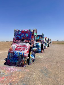
I get super risk averse when traveling alone. I am the only one who can drive Abeona. If I twist my ankle or break my arm, I’m the only one who can drive Abeona to the next spot. I’m not going to take the scary five-mile hike with tons of rock scrambling and roots. I’m also careful about where I park Abeona. Driving a 25-foot RV in Key West was almost as terrifying as driving out of Skagway Alaska. Getting stuck in a tight parking lot or trying to navigate narrow streets is aggravating. There are more than enough times where I will skip something like a museum or a restaurant I want to try because the parking or navigating is just too risky. It’s not worth the stress for me.
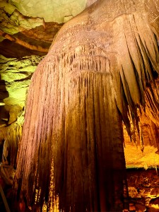
As with anything, the more I travel alone, the easier it is and the more confident I get. I had to live through accidentally dumping the gray tank on the ground and getting the emergency brake to release on a hill at Carlsbad Caverns. As I look back, I realize all the “uh-ohs” that have happened but surviving and learning from each one has been making me more self-reliant. I can either get help from a Facebook group to fix it, pay someone to fix it or go find a hotel. Nothing is insurmountable. It’s all just a patchwork of experiences. I remember when my dear friend, Janine, had a baby about a month before me in 1993. She told me that it’s just not that bad. And it wasn’t. I’m glad I faced my fears and have been on the road discovering so much of the world either alone or with great company. Traveling alone is an adventure of self-discovery.