🛳️ The Ferry to Newfoundland

I just recently traveled from North Sydney, Nova Scotia to Port aux Basques, Newfoundland in June of 2025. This is not my first ferry ride in my intrepid RV named Abeona. My first ferry ride with Abeona was from Bellingham, WA to Skagway AK in the summer of 2024. This was my first trip to Newfoundland and, hopefully, not my last. The Alaska ferry ride is 3 days and the trip to Port aux Basques is 8 hours.  That’s a big difference. I had purchased my tickets for my early June 2025 ride in May of 2024. Over a year in advance.  I had watched a few RV YouTubers and found out that getting space for a larger vehicle AND a berth to sleep in can be difficult, so I planned well in advance. I took the 11:15 PM trip which arrived in Newfoundland at 7:30 AM. There are two ferries a day between North Sydney and Port aux Basques but only one is at night.  I choose the night ferry so that I would have plenty of time to arrive at my next campground. I’m not a fan of setting up camp at night.  Although I had not factored in that the sun wouldn’t be setting until 9:15 PM so maybe that’s not as much an issue as I had anticipated.

As I departed my campsite in Little Bras d’Or, NS, I had twelve hours to kill before the ferry departed at 11:15 PM. I took the opportunity to head to the Cabot Trail of Nova Scotia and to the Cape Breton Highlands National Park. The scenic drive has sheer cliffs, artisan shops and sandy coves. It’s named for explorer John Cabot who was Italian but was commissioned by Henry VII of England to explore North America. He made his voyage in 1497. Every road sign in Cape Breton is written in both English and Gaelic. Cape Breton is quite the melting pot with French, Scottish, English, Mi’kmaq and Irish. Apparently Acadian French, Mi’kmaq, and Scottish Gaelic are spoken here in addition to English. Quite the mélange with a stunning backdrop.

Loading the ferry in North Sydney, Nova Scotia

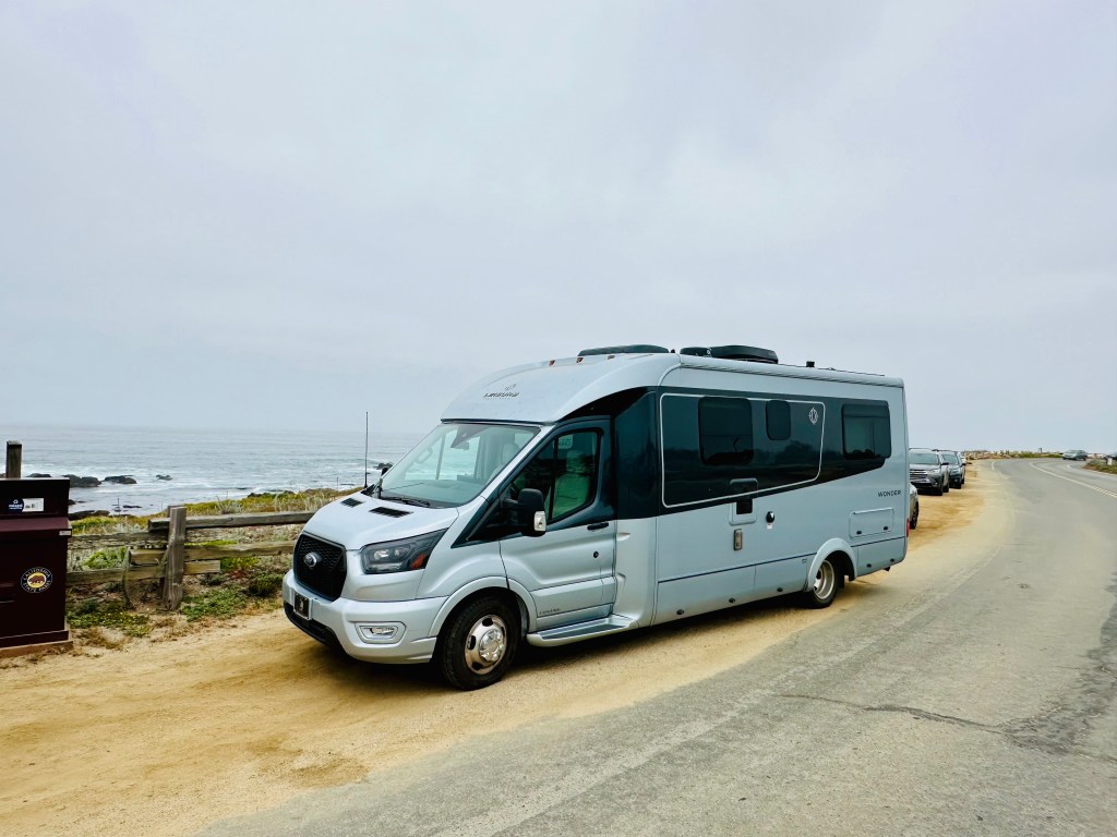
I arrived back to North Sydney and made sure I filled up with gas before getting in line for the ferry some 4 hours before departure. When I had made the reservation last year, I had given the length of Abeona at 25 feet since I was warned not to be under on the length lest they decide we couldn’t fit. A man came out to measure Abeona and we were actually 24 feet so they gave me a 1.24 CAD refund. The agent at the entry booth was very nice and reminded me to shut off my propane before boarding. I was also given my card for my berth by the same agent. 

Abeona and I sat for 3 hours waiting to board. I sat on my bed in the back relaxing and preparing my overnight bag. There were some facilities with a sitting area and bathrooms but I was perfectly happy hanging out waiting for instructions from over the load speaker. They started loading cars and trucks about 2 and a half hours before departure. I have no idea about the masterplan for loading but apparently there are three decks for vehicles. I’m pretty sure I saw at least 25 eighteen wheelers travel up the roadway to the 5th deck which is where all the commercial vehicles are loaded. It’s quite the undertaking.  Abeona and I were loaded about an hour before departure onto deck 3. It’s a back to front loading ferry which is different than the ferry to Alaska which is side loaded and much more complex to get on and off of. It was a relief that loading was so straightforward. 

I tucked Abeona in and grabbed my backpack to travel to my berth on deck 8. I was anxious to get to bed since it was an overnight trip. It was a very nice berth with twin beds, a full bathroom and a porthole! This was an upgrade from my bunk bed with a sink and no window to Alaska. The ship had a gift shop, restaurant and coffee bar and they were all open for the length of the trip. There were also movies being shown throughout the ship.

Once we set sail and the various boarding announcements stopped, I slept really well.  It was also super nice to have a shower right in my room. They refer to these trips as “crossings”. My crossing was very calm and I didn’t see many white caps on the Cabot Strait.  I grabbed a relatively cheap cup of coffee in the morning which was $2.50. Loading for Deck 3 and 5 were the first to be let off the ship once we were docked.  I saw some folks with a dog in the back of the car when I was walking back to Abeona. I can’t imagine leaving a dog for over 7 hours in my vehicle. Unfortunately, you are not allowed access to your vehicle until the ship is docked and the crossing is complete.

Abeona and I easily disembarked and I headed to a grocery store in Port aux Basques, parked and waited until it opened at 8:30 AM. I find it crazy that Newfoundland and Labrador (one province) are a half hour ahead of Atlantic time. So, if it’s 7:00 AM in North Sydney it’s 7:30 in Port aux Basques and my watch and phone automatically updated to the new time. It feels strange to be 30 minutes off from the rest of the world. It’s a small price to pay for this enormous island that is referred to as “The Rock”. I’m looking forward to exploring it for the next month. 

😟Do it Scared

This has been my mantra for the last two months.  I struck out alone for the west coast to attend my mother’s 90th birthday in my RV, Abeona (goddess of the outward journey), in May of 2024.  I’m not mechanically inclined, I am skittish of heights, not a fan of enclosed places and really like a good night’s sleep. This journey would have been a lot easier by just booking a plane ticket instead of driving some 4,000 miles to celebrate my mother’s landmark birthday.  But instead, I have embraced doing it scared.

Abeona arrived on the Pacific Ocean after a cross country trip

Here are the things I faced doing it scared:

Rain in east Texas.  As I was headed to Rusk Texas (look it up, it’s in the middle of nowhere) there were all kinds of warnings on my map apps that the roads could be flooded.  It was a torrential downpour as I drove on desolate route 84 to my campground and out the next day. I saw whole fields inundated with water, rivers out of their banks but never any water across the road. I figured that the campground would have alerted me that it was underwater (and it wasn’t) but the drive was intimidating because of the unknown. 

Big Bend. Big Bend National Park is in the middle of nowhere on the border between Texas and Mexico.  I drove over a hundred miles without seeing a gas station from Fort Stockton down route 385 which enters the park from the north entrance.  I didn’t see one car as I drove down from the north entrance to the park headquarters.  This is rare for a National Park in May but when it’s 112 degrees outside and no cell coverage;it appeared to not be a popular spot in the Spring. When you are driving an RV by yourself and know there isn’t much of a safety net if you break down; you do it scared.

Boquillas Mexico. When I get nervous, my stomach twists in knots. I had a morning planned to cross the border at the edge of Big Bend NP where there is an official entry point into the United States. I knew that it was possible to take a very short row boat ride across the Rio Grande into the little town of Boquillas. I didn’t sleep well in anticipation of crossing the border and back.  I was imagining something going wrong. It’s hot, dusty, no cell coverage and my Spanish was rusty.  As with most uncertain things, I was looking for things to control.  I texted my kids letting them know that I was crossing the border without cell coverage and that I expected to be back to cell coverage in 3 hours. The town itself, my guide and burro ride into town were a step into a whole other reality with this small-town dependent on brave Americans to take a chance on seeing another way of life. I’m glad I did it scared. 

White Sands National Park. I’ve been to over 30 national parks.  I had been to White Sands as a newlywed with my husband, Orlando, in the mid 80’s.  I do not remember the road, about 3 miles into the dunes loop, ending into what was essentially sand dunes for some 10 miles. This mistake, in that I didn’t have all wheel drive on the RV, was something I’m glad I did in retrospect but had I known, I’m sure I would have skipped. Getting my Abeona stuck in the sand and the rattling of the dual tires in the back was unnerving. I turned around as soon as I could but I can tell you to pay more attention to park maps and advisories now.

Tehachapi Pass. This is an infamous road that skirts Los Angeles through a mountain pass.  I have been over it several times in a car although I probably wasn’t driving.  When driving up from the south there are over 4,500 wind turbines which, immediately alert you to the fact that “there will be wind.” On the day I came up the pass from the south there were signs alerting high profile vehicles.  My campground was on top of the pass.  I went anyway. Gulp.  It felt like hurricane force winds, I was clenching the steering wheel and maintained a 45 mile an hour pace.  I was fortunate that there weren’t may trucks and gratified to see other folks with trailers going over the pass (if they can do it, I can do it). After 4 camping days in Tehachapi, I came down the other side of the pass which is longer, steeper and full of curves (it forced me to learn how to use manual gears).  I kept thinking to myself, Rick Hanson’s “Are you alright right now?” I was.

Glider Ride. When I was camped in Tehachapi, it was right next to a glider plane airport.  After the first two days of watching gliders take off attached to small planes, I decided that, if I don’t do this, I’ll regret it. I had every afternoon free and why not just walk over and get in a glider. I was going to tell my daughter but she was occupied so I just went over and did it.  In retrospect, I think that because I was by myself, I couldn’t be talked out of it.  Perhaps someone else would have discouraged me.  Maybe I thought I had survived the trip thus far, let’s go for broke. I was shocked that all you had to do was pay and that I didn’t sign 5 pages of waivers.  Perhaps it was because I didn’t sign waivers, I decided it was safe.  My pilot Cam was great.  They wheeled the glider into position. There was nothing but manual signals between him and the pilot of the guide plane.  The glider itself was airborne before the guide plane which was freaky.  Did I mention that I was in the front of the glider with all the controls to fly (but didn’t).  When the tow rope releases, we were gliding above the Tehachapi Valley at 6,500 feet.  Outside of the wind and the conversation with Cam, it was silence. It’s incredible that this little plane, that is shorter than my RV can glide through the air without any technology and land safely on the ground.  I’m glad I did it scared.

I find that, traveling alone as a woman over 50, I get a lot of folks opining on my choice. Mostly it’s from women over 50 saying “I could never do that”, “So you are alone? Driving by yourself?” I’m always flummoxed as to what to respond with.  And then?  Then there is Lucky Lu (her license plate).  I was departing Joshua Tree and at a stop light in Yucca Valley when I hear a car honking at me. I turn to the left and see a woman beaming and giving me the thumbs up.  I rolled down my window and she said” You have the toy I want!  I love it!  Are you by yourself?”, I answered yes, and she responds “YOU GO GIRL!”  That moment?  That was worth it all. There is also my co-pilot, my inspiration, my dearly departed father had wanderlust in spades and he would drive 4,000 miles just to see a view.  Daddy is always riding shotgun.

🚎Enchanting New Mexico


I spent two years living in New Mexico and even gave birth to my fabulous daughter, Natalie, there in 1993.  My original visit in 1992 was to turn around a failing restaurant for the company I was working for and I spent every free day off traveling the back roads of New Mexico. I investigated parks and archeological sites around the state like Bandelier National Monument, Chaco Canyon, Acoma Pueblo, Taos and, my favorite, the artsy, unique Santa Fe. I focused mostly on the northern half of the state because I was based in Albuquerque.  Outside of the wonderful, Bosque de Apache, which is probably the best wildlife refuge I’ve ever been to; think thousands if not tens of thousands of sandhill cranes and snow geese, I had never ventured much further south on my own. 

Climbing in Bandelier National Monument in 1992

Southern New Mexico is home to three noteworthy stops: Carlsbad Caverns National Park, the town of Roswell, and White Sands National Park.  There is also a bonus National Park called Guadalupe National Park. It’s actually in Texas even though it’s only 20 miles of Carlsbad Caverns and none of the clocks (including my apple watch) acknowledged that it’s Mountain Time, Guadalupe is on Mountain Time and not Central Time. 

I initially visited Carlsbad Caverns NP on my trip to the west coast in the mid 80’s with my then husband, Orlando.  I was really looking forward to getting back to the caverns to revisit and to also get out of the extreme 100 degree plus heat that is southern New Mexico in late May. Regardless of the time of the year, I visited on a Friday in May. The parking lot was about 3/4 full. I was surprised except that everyone else was probably trying to escape the heat as well.  I had no problem getting a ticket for the self-guided tour of the caverns but that was probably because the elevator wasn’t working.  Gulp. They made it very clear that I could walk down the 79 stories to the bottom of the cavern (and more importantly the walk back up).  I hesitated but decided that it was worth the try to get down to the bottom which is billed as an extremely steep and difficult 1 1/4 mile  hike down.

So, the walk down is dark and steep and although they advertise “hand rails”, I would bet that’s only about 20% of the walk.  There are no steps so it’s a long winding paved trail down with upwards of 30 switchbacks and most of it is either dimly lit or dark. The opening at the top of the caverns is enormous and there were hundreds people including school groups at various stages of either traveling down or traveling up (remember the elevator was not working). There were upwards of fifty wrens flying around the entrance during the walk down but apparently the wrens are replaced by bats at nightfall.  I made it down about a mile and saw one more very steep descent and, being that I was traveling alone and still had a two-hour drive to Roswell to camp in my RV, Abeona, I decided to turn around. It was still worth the trip down but since I have only myself to depend on this trip, I felt it was prudent to turn around. There were several formations that I got to see and walking down some 60-ish flights is pretty amazing.  I also met several people on my hike down and up as we were all suffering from the lack of elevators.  I remember the elevator in my first trip there with Orlando.  It was quite the journey down into the belly of the cavern.  I would definitely go back but make enough time to be able to complete the trip or be whisked down in an elevator.

Roswell is worth the stop even if you’re not into all things alien.  This town has totally embraced its UFO identity.  The street light posts are painted like aliens, there are alien themed window paintings and signs throughout the town including a picture of an alien taking money from an ATM at a local bank.  There is even a credit union with a space ship in its logo.  If it’s from outer space, it’s in Roswell.  This all stems from the Roswell Incident when an alleged UFO crashed nearby in 1947.  There are several museums including The International UFO Museum and Research Center, Roswell Space Center, Roswell UFO Spacewalk and Alien Zone.  For a town of close to 50,000 people, that’s a lot of museums dedicated to space and aliens. I went to the UFO museum and for $7.00, it was worth it just for all the interesting displays. If you are really into all things alien, the UFO festival in early July is not to be missed by everything I read.

My last stop on my trip west in New Mexico was White Sands National Park.  Orlando and I had visited here as well back in the 80’s.  I remember the park being basically vacant on our early November visit. Fast forward to this year and considering it was over 100 degrees there were about 100 or so folks in the visitor center. After going through the visitor’s center, I headed out to the 10 mile loop road through the white sand dunes.  I should have read the map or asked about the road conditions before I headed blindly out on the Dunes Road.  About 3 miles in there was a sign on the side of the road that said “pavement ends.”  Did I mention I was driving my new RV?  I was not expecting to be on sand for 8 miles. Whether I liked it or not, there I was driving on sand for about 2 miles until there was a large turn off to park.  It was exciting to get on top of the dunes and see nothing but white dunes for as far as the eye could see.  It also was a terrific surface to reflect the hot sun back.  As much as I wanted to go the entire loop as I remember Orlando and I doing almost 40 years earlier, I wasn’t willing to risk getting stuck in my RV without 4-wheel drive.  I turned around and headed back but even the one stop was worth it. Similar to my visit to Death Valley a few years ago, it’s so amazing to experience the vast array of topography and elements of the western United States. 

Between the art and architecture of Santa Fe, the wildlife of Bosque de Apache, the depths and vastness of the Carlsbad Caverns, the expanse and beauty of White Sands and the quirky, out of the world Roswell, it’s all so enchanting.  I think I could return again and again and continue to find more enchantment.

🤠Southwestern Oddities on My Travels


I’ve been traveling for almost 4 weeks in my RV, Abeona, through West Texas, Southern New Mexico and Arizona during the Spring of 2024.  There are some oddities that you just don’t see in Durham, NC, where my home is. I am familiar with some of these things as I lived in Albuquerque in the early 90’s but I have been genuinely surprised by some of these phenomena and roadside attractions.

West Texas

Here are some of the oddities I found on the byways of the Southwest:

Hitchhiker warnings.  I can remember my brother Rick and me driving through Arizona back in the 90’s and there were several signs about not picking up hitchhikers because we were near a prison facility.  First of all, are there really that many prison breaks that meant they needed signs for this? Secondly, wouldn’t it be pretty obvious that they were escaped prisoners?  I can remember at the time of my road trip with my brother that we were low on gas.  We were worried that we would run out and, due to the signs, we wouldn’t get help.  This was pre-cell phone. These signs are still there in New Mexico and Arizona and they are miles from the nearest prison. 

Tumbleweeds.  I always thought tumbleweeds were a creation for Looney Tunes when I grew up in the suburbs of Northern Delaware.  But tumbleweeds are for real and are quite jolting when driving down an Interstate at 70 miles an hour. They move fast and steam roll across the road out of nowhere.  

Prada Store.  There is an art installation along Route 90 near Marfa TX that looks like a small Prada Store complete with handbags and some shoes. I had been driving for about 2 hours as I was leaving Big Bend National Park and suddenly see this small store on the side of the road in the middle of nowhere.  I mean nowhere.  I’m thinking, who in the world would travel 3 hours to shop for Prada shoes? I didn’t know until later that it’s an art installation.  Crazy.

Giant Movie Roadside Tribute. Not far from the Prada Store in Marfa on Route 90 is a plywood tribute to the 1956 movie starring James Dean and Elizabeth Taylor.  There is a reproduction of the house James Dean, Elizabeth Taylor and Rock Hudson behind the wheel of a big yellow car. I can’t tell you how badly I wanted to stop and take pictures but, in an RV, it would have been too hard to turn around. 

Paisano Pete.  This is on a corner in Fort Stockton, TX.  It’s the second largest roadrunner in the world and stands 11 feet tall and has been there since the 1980’s.  At the time it was the largest roadrunner in the world until Las Cruces put in a larger roadrunner statute in 1993.  

Dust Storms.  If you have driven on Interstate 10 in southern New Mexico and Arizona, you are familiar with large yellow signs warning of “Dust Storms for the next 40 miles”.  They even have instructions on what to do (like don’t stay on the main roadway).  There was at least 200 miles of warnings of possible dust storms and I was there on a very windy day but luckily there were no storms as I was passing through.  The main upshot is that it’s windy and dusty and when they combine, it’s dangerous.

Ruidoso Bed Races.  There is an annual bed race in Ruidoso, NM.  This is a very small town in the hills of New Mexico between Alamogordo and Roswell.  I remember bed races when I was in college so seeing this annual event advertised in this tiny town in New Mexico brought back memories.

Deming Duck Races.  I immediately thought that this would be little yellow ducks which I have seen at charity events.  But no, in Deming, New Mexico, these are live ducks who race through the water to the finish line. In addition, there is a Tournament of Ducks Parade and a Duck Royalty pageant.  Random but looks like fun.

Some of these oddities are upward of hundreds of miles apart on the long, dusty roads of the southwest. It’s lonesome, dry and miles of long vacant high desert and hills.  It felt like an Easter Egg Hunt when I ran across some of these interesting oddities hundreds of miles outside of a large metropolitan city.

🏖️The Mysterious Driftwood Beach

I visited Jekyll Island, Georgia this past February and found it to be a mysterious and inspiring place along the Golden Isles of the Georgia barrier islands.  It has quite the history and an incredible Driftwood Beach which should be on everyone’s bucket list.  I was on my maiden voyage with my RV, Abeona, and we were on our way home from Florida. We camped for a week at the campground on the northern end of the island. 

Sunrise at Driftwood Beach, Jekyll Island, Georgia

I didn’t have a tow vehicle or a bike with me on the trip, so being within walking distance of the beach was a high priority (I didn’t want to pack up everything to go see the sunrise). The Jekyll Island Campground is the only campground on the island and I had no idea that it was just a mile from Driftwood Beach when I booked the campsite.  Imagine my surprise when I found that the beach was an easy walk each morning to photograph the sunrise. Serendipity. 

After arriving at my campsite, I decided to venture out to the beach during the daylight so that there wouldn’t be any surprises when I walked to the beach in the morning for sunrise. Arriving at around 4 PM on a Saturday afternoon after the mile walk to Driftwood Beach, I was astonished by how many cars were there and therefore, people on the beach.  This is not an umbrella and beach towel type of beach.  This is a photographer’s (re Instagram) Mecca. It also happened to be high tide. 

Driftwood Beach is a maritime forest that has been slowly overtaken by the sea.  There are hundreds of trees standing, fallen, eroded and sometime petrified, covered in barnacles on the beach. They are all driftwood, just most are full size trees as driftwood. Some stand as sentinels at attention with no branches, others are on their sides with their root structure solidified in an intricate web. Some look like they are trees on stilts with roots that grew long and straight in order to stay above the salt water.  It is mesmerizing to walk along the several hundred yards of what looks like a waste land of gray figures strewn haphazardly along the beach. 

The trees of Driftwood Beach stay on the beach because it’s very shallow for hundreds of yards off shore.  The waves are never high enough to pull them out.  In fact, when I first arrived, I thought I was in a bay because the water was so tranquil. Due to the shallowness, the trees over the last century have stayed where they have fallen. 

Jekyll island is a state owned and maintained island.  This means there aren’t any big resorts or towers along the beach. There were plenty of photographers each sunrise.  This was quite the contrast from when I recently stayed at a North Carolina barrier island of Ocracoke, where I was the sole person on the beach at sunrise.  Each morning at Driftwood Beach there was a minimum of twenty photographers each time I went out. Most with chairs and tripods, patiently waiting for that perfect shot as the sun slipped above the horizon. 

The real key to sunrise on Driftwood Beach is to know where the tide is and whether or not there will be clouds.  Some clouds are magical; when it’s fogged in, not so much.  If the water was high enough there were pools around some of the fallen trees making for a terrific reflection or you could capture the sun “caught” amongst the branches of the trees.  I had a ton of fun wandering up and down the beach looking for the magical combination of sun, tree, waves and cloud.  

It all seems so mysterious.  Like you are walking amongst fallen statues after some catastrophe. Like some civilization left these corpses behind.  The shape, the beauty and the serendipity of light, water and wood was amazing.